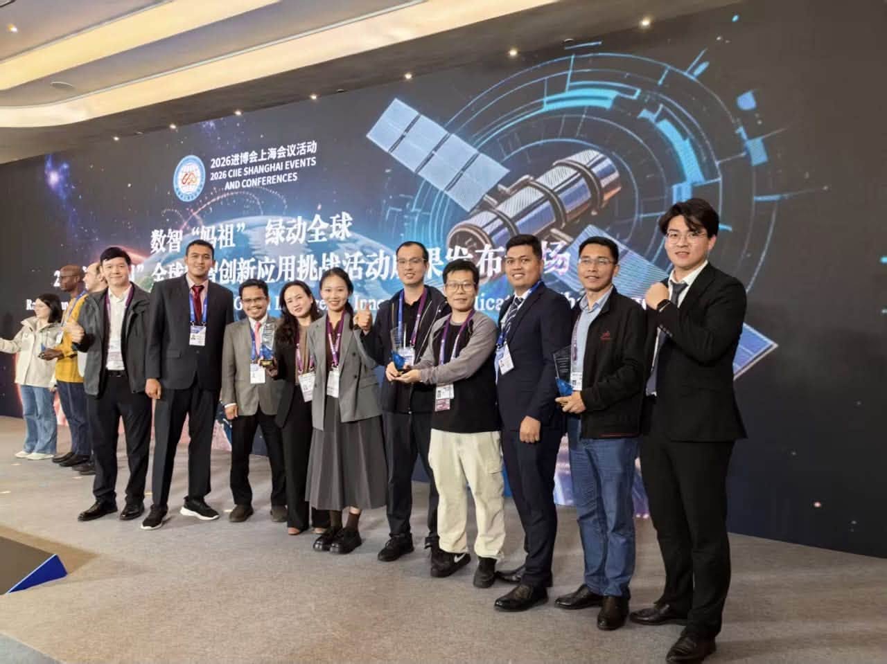
UMPSA’s MyLandslide-AI Innovation Recognised Among Top 10 Benchmark Scenarios at MAZU 2026 in China
SHANGHAI, 7 November 2026 – Universiti Malaysia Pahang Al-Sultan Abdullah (UMPSA) has once again brought international recognition to Malaysia through its innovation, MyLandslide-AI, an artificial intelligence (AI)-based platform for landslide monitoring, risk assessment and early warning. The innovation was recognised as one of the Top 10 Benchmark Scenarios at the 2026 MAZU Global Intelligence Innovation Application Challenge, held in Shanghai, China.
The recognition by the China Meteorological Administration (CMA) marks a significant achievement for UMPSA in the fields of satellite technology, Global Navigation Satellite System (GNSS), artificial intelligence and disaster risk management. The award was received by Professor Ir. Ts. Dr. Kamarul Hawari Ghazali from the Faculty of Electrical and Electronics Engineering Technology (FTKEE), who is also a research fellow at UMPSA’s AIT Research Centre. He also presented the MyLandslide-AI innovation to the judging panel and international participants.
MAZU 2026 attracted entries from 36 countries, with only 20 innovations selected to advance to the final stage. Of these, 10 innovations received the Top 10 Benchmark Scenarios recognition, including MyLandslide-AI, which showcases the outcomes of Malaysia–China research collaboration. The competition also served as a platform for international researchers and technology experts to present innovative solutions in weather forecasting, meteorological technology, disaster early warning systems, satellite data analysis and AI applications to enhance public safety and preparedness.
The recognition ceremony was held in conjunction with activities related to the 2026 China International Import Expo (CIIE) in Shanghai. Among the senior leaders in attendance were Zhang Yuxin, Deputy Secretary-General of the Shanghai Municipal People's Government, and Zhang Xingying, Director-General of the Department of International Cooperation, China Meteorological Administration. The event was also attended by representatives from meteorological agencies, research institutions, universities and international organisations.
According to Professor Kamarul, the development of MyLandslide-AI is the result of UMPSA's continuous research over the past 10 years, beginning in 2016, in the areas of ground movement monitoring, GNSS technology, rainfall data analysis, satellite data utilisation, artificial intelligence, and landslide risk modelling and prediction. Initially focused on monitoring slope movements using GNSS technology, the research has since evolved towards developing a Multi-Source AI model that integrates multiple data sources, including rainfall data, satellite observations, GNSS/BeiDou, field sensors and geospatial information to support risk assessment and the development of landslide early warning systems.
"This recognition marks an important achievement after almost ten years of research in landslide monitoring and risk prediction. In the early stages, our research focused primarily on using GNSS to detect slope movements. Today, our research has expanded to incorporate rainfall data, satellite technology and artificial intelligence to develop a more comprehensive approach to risk assessment," he said.
UMPSA's research has also involved collaboration with the Public Works Department (JKR) in assessing landslide-prone areas, including site visits in Cameron Highlands, Pahang. This collaboration has provided researchers with opportunities to understand the actual requirements of slope monitoring, particularly in highland areas and along road corridors exposed to heavy rainfall and ground movements.
The key strength of MyLandslide-AI lies in its Multi-Source AI approach, which enables different data sources to be analysed collectively to understand the factors affecting slope stability. Among the data sources used or proposed for integration into the platform are meteorological and Earth observation satellite data, such as China's Fengyun-4B (FY-4B), Japan's Himawari, Sentinel-1 and Sentinel-2 from Europe's Copernicus programme, as well as NASA's Global Precipitation Measurement Integrated Multi-satellitE Retrievals (GPM IMERG) rainfall data.
The platform also integrates GNSS and BeiDou data with other satellite navigation systems, including GPS, Galileo and GLONASS, to measure changes in position and slope movements. In addition to rainfall data from meteorological stations, rainfall intensity and accumulation, and weather forecasts, field sensors such as soil moisture sensors, slope inclination sensors, ground crack sensors and water level sensors help identify changes in local ground conditions. Geospatial and geological information, including topography, slope gradients, soil types, geological conditions, land cover and historical landslide records, also forms an important component of the analysis process.
Through this approach, AI has the potential to identify complex relationships between rainfall distribution, changes in soil conditions, slope movements and environmental factors that contribute to increasing landslide risks. Satellite data enables analysis over wider geographical areas, while GNSS and field sensors provide more detailed information at specific monitoring locations. Combining these two approaches has the potential to strengthen landslide monitoring and risk assessment capabilities in a more systematic manner.
Professor Kamarul further explained that landslides are complex phenomena influenced by various factors, including prolonged rainfall, geological conditions, soil moisture content, slope gradients and changes in slope movements. Conventional monitoring methods generally rely on sensor readings or specific threshold values to identify potentially hazardous conditions. However, advances in AI technology create opportunities to develop models capable of analysing more complex data patterns, detecting anomalies and generating risk assessments based on a combination of multiple parameters.
"In disaster management, time is a critical factor. The earlier a risk can be identified, the more time the authorities have to implement preventive measures. The use of Multi-Source AI enables information from satellites, rainfall data, GNSS and field sensors to be analysed collectively to support the early detection of changes in conditions that could increase landslide risks," he explained.
He also emphasised that AI is not intended to replace the expertise of geotechnical engineers or disaster management agencies. Instead, it serves as an AI-Driven Decision Support System to assist in risk assessment and management processes.
MyLandslide-AI's achievement in the competition also attracted attention from international media outlets, including China Global Television Network (CGTN), People's Daily Online, Shangguan News, The Paper and Knews Shanghai. In a CGTN report titled "AI for Early Warning: China Unveils Top Ten MAZU Application Scenarios at CIIE", published on 10 November 2026, Professor Kamarul was also interviewed to share his views on the importance of meteorological technology, satellite data and international collaboration in developing disaster early warning systems. This media coverage has further increased the visibility of UMPSA's research, particularly in artificial intelligence, satellite technology and landslide risk management.
As part of its long-term direction, the UMPSA research team also plans to submit a proposal to the Malaysian Government for the development of a National AI Landslide Monitoring and Early Warning Hub. The proposed hub has the potential to serve as an integrated centre for satellite, meteorological, GNSS, field sensor and geospatial data to support the monitoring of landslide-prone areas throughout the country.
Through AI model development, the proposed hub is envisioned to support rainfall analysis, anomaly detection, risk assessment and the dissemination of early warning information to relevant agencies. According to Professor Kamarul, this proposal represents one of the long-term initiatives that could be considered to strengthen Malaysia's capacity to leverage AI technology in disaster risk management.
"Our goal is not merely to develop research technology, but to ensure that our research outcomes have the potential to be translated into practical solutions that benefit the nation. We aspire to propose the development of an AI-based landslide monitoring hub that can integrate multiple data sources and assist government agencies in assessing risks and planning preventive measures more effectively," he said.
The recognition of MyLandslide-AI at MAZU 2026 serves as a catalyst for UMPSA to further strengthen its research, expand international collaborations and develop technologies with the potential to contribute to public safety, infrastructure protection and disaster risk reduction in Malaysia and the ASEAN region.